|
Leaving Delegal Creek
(notice empty osprey nest) |
They changed the weather forecast for Friday so I thought I
would take my kayak out to an extended trip.
I launched at Delegal Marina a little before ten, knowing that I had
just over an hour before the tide turned.
The winds were stronger than expected, coming out of the south, which
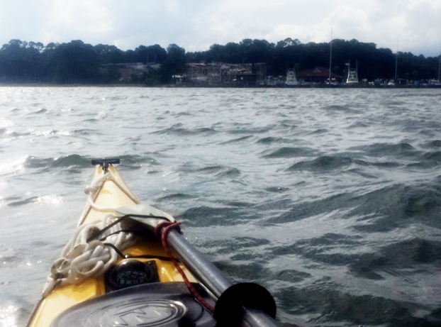
provided resistance as I paddled out of the creek. By the time I was in Ossabaw Sound, the wind
was coming off my starboard side and I found the skeg worked wonderfully as I
maintained a straight line toward the south end of Wassaw Island. The last mile or so, as I paddled by the
shoals off Pine Island, the waves began to build. As I crossed the entrance to Wassaw Creek, I
was paddling in three foot waves. The
boat handled perfectly. I made the five
mile paddle to the island by 11:15 (which would be close to 3.5 miles an hour
which wasn’t bad with the waning tide).
 |
| Ranger station on Wassaw |
Normally I would be ready to crawl out of the boat, but it was so
comfortable that I paddled about a mile and a half up into Wassaw Creek,
stopping at the ranger station for the National Wildlife Refuge. There was no one there, except for a couple
of fishermen who had decided to hole up under their dock. They fished there, in the shade for over an
hour and I think they caught one fish. I
pulled out on a sandy beach a ways down from the station, took out my lunch and
hammock, and found two perfectly spaced trees up on a high bluff where I could
enjoy a nice breeze. I strung the
hammock and then had lunch.
 |
| Lunch stop |
 |
| Lunch stop |
 |
| The Good Life |
My original plan had been to return the way that I came or
back through the Odingsell River, but I have always wanted to try to paddle
through Romerly Marsh to the north end of Skidaway Island. I’ve done this
before, paddling in the ocean, but I wanted to go through the marsh. I figured it would still be close to 17 miles
(the distance it is in the ocean) due to the curves in the creeks. I knew there is a dredged cut I’d have to
find, and it’s not very wide. I made a call to get picked up at the Priest
Landing marina and headed out about 1:30.
I was hoping to be back around 3:30, well before any afternoon
thunderstorm.

This turned out being harder than I thought. The map showed the cut being further from the
Parson family holdings on the island than I thought (they were close to the
docks), which I discovered after spending an hour going down false leads. When I made it back into the main creek, saw
someone on the Parson family dock, I paddled over and asked if they could help
me. They pointed me to the right channel,
told me to take the second left, which would be marked with a PVC pipe. I never did see a pipe (in a kayak I’m a lot
lower than someone standing in a boat).
I got lost again, but thirty minutes later I had found the cut. Each time I got lost, I had to paddle back
against the tide. By this point, I was
tired. I had also broken a paddle, but thankfully had another with me.
The Parson family purchased the island in the 1860s. In 1969, they sold all but a 150 or so acre holding to the Nature Conservancy for one million dollars. They, in turn, sold the island to the government to be used as a wildlife refuge. This kept the island from being developed and it is considered one of the most natural islands along the Georgia coast, since it has never been farmed, logged, or used for raising livestock. The only development on the island are several homes in the Parson holdings, the Refuge ranger's station, and a Spanish American War era battery on the north end that is slowly eroding away.

The marsh is an interesting area. There are a number of hardwood hammocks
within the marsh (with live oaks and sort) and these trees were filled with a
variety of birds. I saw several osprey,
ibis, egrets, a variety of ducks, sea gulls and pelicans. I love watching pelicans fish and one dove
into the water not more than 20 feet from my boat, making a big splash. As he came up, he threw his head back and
swallowed. I also saw a couple of
alligator in the marsh. One, I surprised
as I paddled around a bend. He jumped
out into the water and almost hit my boat as he dove under it.
 |
| Dead end |
As I floundered in the marsh, I kept looking for where the
tide was going against me as I headed in the right direction, for I knew then I’d
be paddling out toward the Wassaw Sound.
High tide wasn’t until 5:20 PM, at which time I could probably make it
through over the marsh grass, but then I would have to paddle against the tide
back to the marina. When I found the cut
and where the tide changed directions, it felt good, as I was now sure that I
had only a couple of miles before I would be in Wassaw Sound (and then five
more miles before I was at my destination).
 |
| In Wassaw Sound |
Once in Wassaw Sound, I turned inland. In the distance, a storm was brewing. It was already after four. I would paddle hard for a bit and then
rest. Thankfully the ocean breeze was
strong and to my back, as it gave me a push and also kept the thunderstorm from
moving over me. Instead, the storm moved
north, parallel to the coast. Yet, it
was close enough that I saw a dozen or so strikes of lightning. Once I
entered the Wilmington River (where I regularly sail) I felt safe.
I arrived at the marina at 5:40 PM. I figured I’d paddled over 20 miles, but I
had fulfilled my goal of paddling across the marsh.
 |
Destination in sight
(notice broken paddle)
The Skeg (photo to answer questions below) |
 I took last Friday off and for the first time in a month had
a full day to kayak. It was a beautiful day for early November, clear skies and temperatures in the low 80s. Leaving the Landings Marina on the north end of
Skidaway Island, I paddled out into the Wilmington River with the falling
tide. Along Cabbage Island, which sits on the north side of the Wilmington River, I stopped to relieve myself of some coffee and explored a little creek that flowed through the marsh.
 I took last Friday off and for the first time in a month had
a full day to kayak. It was a beautiful day for early November, clear skies and temperatures in the low 80s. Leaving the Landings Marina on the north end of
Skidaway Island, I paddled out into the Wilmington River with the falling
tide. Along Cabbage Island, which sits on the north side of the Wilmington River, I stopped to relieve myself of some coffee and explored a little creek that flowed through the marsh.