This is a continuation of my hiking in the Upper Peninsula
back in August. Go here for Driving to the Porcupines, here for Backpacking in the Porcupines, Part 1,. and here for Backpacking in the Porcupines, Part 2
 |
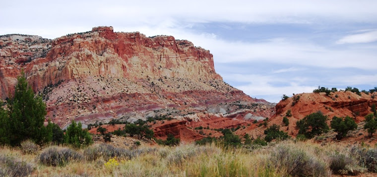
| hiking along Picture Rocks Lakeshore |
Leaving the Porcupines Mountains, I was running low on
fuel. There had been a gas station right
outside the park, but its pumps were covered up. I drove north along the lakeshore to the
beautiful town of Ontongon, where I filled up with gas. I was pleasantly surprised to see gas prices
had dropped a bit while I was hiking (I’d paid 4.17 the day before I started
hiking and most places I’d seen in the Upper Peninsula (UP) had been well over
the $4 mark. Gas has always been higher
in the UP. At Ontongon it was
$4.04. I filled the tank and drove east
on highway 28, crossing through a heavily wooden area south of the Keweenaw
Peninsula. At L’Ase, I headed south on
US 41, toward Marquette. The sun was
dropping low in the sky and I decided that I needed to find a place to pull off
before I got into the Marquette area. I
picked up some dinner at a dinner and then stopped at a state park campsite on
Lake Michigamme. It was a little more
than I wanted to pay for sleeping in the cab behind my truck, but they had
showers and so I forked over the dough and found a place to camp and then,
after dinner, headed to the showers. The
next morning I was up early and stopped for breakfast at a place just outside
of Marquette, before driving on the Musining.
As I expected, the backpacking campsites at Picture Rocks were all
claimed so I decided to do a day trip and then find a place where I could camp
in my truck. After getting a map of the
area, I brought a 12 inch sandwich at subway and headed to the Chapel Road
trailhead. I knew this place was
popular and the number of vehicles proved it.
The parking lot was full and I had to park along the side of the road. I got out my daypack, put in my camera, a
journal, food and a map, and rain gear (there were calls for late afternoon
thunderstorms) and headed out.
 |
| Chapel Rock |
Unlike the Porcupines, the trails in Picture Rocks are fairly
level. From the parking lot, I head down
the Chapel Rock trailhead, through a mixed forest of beech, maple, hemlock and
pine. The forest is rather open and the
trail appears to have been an old two-track dirt road that in places is lined
with delicate columbines. I pass through
a few groves of beech with dead or dying trees and another hiker suggest it’s
the emerald ash borer that has been killing the ash in the Midwest, but I later
learn that’s not it at all and thankfully I did pass many healthy groves of
beech before the day was done.
 |
| Chapel Rock Falls (how do I get this right-side up?) |
A mile
or two into my hike I came upon Chapel Lake falls. I explored the falls from the south side,
which is right on top of the falls and where one had to be careful lest you
slip and tumble down the side of the hill.
From the north side there was a nice overlook and I sat there and
watched the falls while I ate ½ of my subway sandwich. After lunch, I headed down toward Lake
Superior, another mile and a half away.
 |
| Storm Clouds developing |
The trail ends at Lake Superior where it intersects with the
North Country Trail which hugs the shoreline.
Here is also Chapel Rock, one of the neatest rock formations I’ve seen. Carved out of sandstone and sticking out at
the edge of the water, the sandstone pillar rises 60 or so feet into the
sky. On top of it is a solo white pine
that sticks up like a steeple. But the
amazing thing is that the rock island has an anchor line back to the mainland,
a thick root from the pine that still links the tree to the sandstone cliffs
overlooking the lake. This root would
have been there when Chapel Rock was connected to the mainland, but reports of
the unique rock were first made nearly 200 years, so the tree and the formation
is old. Immediately, I think about how
easy it would be to scoot across the root to gain access to the top of the rock
island but there are fences and signs warning would be adventurers of the penalties
for such an infraction of park service rules.
And it is a good thing for there are plenty of people here enjoying the
fragile formation and it wouldn’t take too much mischief to cause irreversible
damage.
After enjoying the rock, I hike west on the North Country
Trail for what is said to be the best views along Picture Rocks. I am not disappointed. For four and a half miles, I walk on cliffs a
100 or so feet above the crystal clear waters of Lake Superior. Below, tourist boats from Munising cruise by
and further out into the lake I watch several ships with iron ore sail
pass. I’m passed by a number of
backpackers and some day hikers, but most keep on walking where I find myself
constantly stopping in awe of the beauty around me. At one of the many lookouts, I strike up a
conversation with a couple that had asked me to photograph the two of
them. They’re on their honeymoon and
when we get to talking about where they live in California, I mention a couple
who were friends of mine from Utah who’d moved there. She screams, “Angie and I are best friends.” The world sometimes can be a small place!


At Grand Portal Point, the trail turns to the southwest,
providing an open view of the western sky that is darkening. I watch a storm pass over Grand Island and
rush across the water to the mainland. I
pull on my rain jacket and keep hiking.
The shower was short lived, but there are more showers that keep popping
up, none lasting very long. During a
lull in the showers, shortly before reaching Mosquito Beach, I stop to eat and
down the rest of my Subway sandwich. I
hike on. It is raining hard when I hit
Mosquito Beach, so I look around quickly and then retreat back into the woods
where the vegetation makes the rain seem like a mere sprinkle. Because of the rain, I decide to take the more
direct Mosquito River trail instead of the longer Mosquito Falls trail. It rains most of the three miles back to the
trailhead, only stopping for good about the time I arrive back at the
truck.

You find the most amazing places to share, and your descriptions of these places makes me feel like I was there myself. Such awesome photos as well. This post, as well as your others of the UP really urge me to take another trip up there myself. Not now that winter is approaching. We had 72 degrees here in Minnesota on Saturday, this evening right now, it's 19 degrees. Yes it's Brrrrrrrrrr!
ReplyDeleteThat portal is gorgeous. What a gorgeous hike! And so amazing you had a six degrees of separation encounter. :) Eating outdoors on such a hike must be wonderful.
ReplyDeleteDon't know about the rest of you Jeff but may your legs be forever young.
ReplyDeletedang...love the rocky coast man...the formations in them are amazing...chapel rock is very cool as well....i have to wonder at times what makes them wear that way....what a hike....
ReplyDeleteI love hiking along Lake Superior.
ReplyDeleteI have sometimes had problems with pictures that refuse to flip over. The solution that works for me everytime is that you have to open the picture up in a photo editing program of some sort and then save it. But it means you have to reload it into blogger when you are done. I wish blogger would come up with a way to let you do it after you have already uploaded it onto your blog.
Great pictures and description of the hike. Thanks....BTW, they're called foot-longs. In Subway Spanish, it's "pan grande." Keep on keepin' on.
ReplyDeleteYou know, I see stuff like this and I think, 'that ain't real. it's too beautiful'.
ReplyDelete:-)
Pearl
Wow, some truly awesome images. Chapel rock is cool, and the cave/tunnel under the rocks
ReplyDeleteWonderful photos. Is that tree growing out of the top of Chapel Rock? I saw a similar one once.
ReplyDeleteCan't believe you met a couple who knew your friends from Utah - that's too weird!!
Yes, to answer your question, we are doing the Governor's Mansion this year and I will, of course, post photos. Wish you could come and tour it in person!
Sage: You hike fearlessly to the most amazing and challenging places. Yes, I too have noticed gas prices are quite different throughout the country!
ReplyDeleteSo gorgeous! I need to head up there sometime! I've been, but it was a long time ago when I was a little kid. Great pictures and post!
ReplyDeleteBeautiful falls and greenery and I like how you share your stories in detail to make us feel like we're with you every step of the way. You leave me wondering how it would feel to hike alone and sleep in my truck, eat at diners...something I'll never do but in a safer world would totally consider it. Something about nature totally fascinates me yet terrifies me (being all vulnerable out there). You never seem to express any fears or concerns. I wonder why that is.
ReplyDeleteOh my, your post just makes me want to go hike so bad...
ReplyDeletehappy thanksgiving man...i hope you are spending surrounded by those you love...
ReplyDeleteHello and gobble, gobble, GOBBLE! I hope you're having a wonderful family filled fun and loving Thanksgiving! I'm so thankful that you are blogging here too! Take good care- Karen
ReplyDelete