Monday, November 26, 2012

A short poem


In the detail, God hides.
Quiet and attentive we must be,
less we miss the splash
of a trout rising to the surface
the droplets of water suspended in air
for just a moment
and in the setting sun appear red,
like blood.

Friday, November 23, 2012

Thanksgiving and Black Friday and a little TLC for my canoe

Thanksgiving Day project

While everyone else was watching the Macy’s Parade, I began to work on my canoe.  I’ve had this canoe since the mid-80s and it’s still in decent shape except that the gunnels had begun to rot.  I had changed the gunnels once before, in 1992.  In both occasions, I found a small sawmill who would rough cut the gunnels.  Right now, there is a lot of ash available (in 20 years, this won’t be the situation as the Emerald Ash Borer is wiping out the Ash in this part of the world).  A guy who often has breakfast at one of the local diners and does logging has a band-saw mill.  He had some 20 foot ash logs he was rough cutting into planks for someone else and was able to cut my strips out so some of the slabs.  After cutting them, I took them to another friend who has an incredible planner and we worked the strips down to 7/8” by 3/4”.   When I did the gunnels in 92, I oiled them first, which is what most people recommend.  This time, I decided to spar varnish the gunnels before I placed them on the boat.  I put three coats of varnish onto the gunnels before Thanksgiving.

Thanksgiving was a wonderful day here—I was able to work outside without the need of a heavy coat.  I placed the canoe on a set of sawhorses and began to take the out the seats and thwarts.  Then I took off the first side of gunnels, saving the stainless steel screws, and to replace the old gunnels with a new set.  To do this, I start at one end and with four clamps, began to drill countersink holes for the screws.  When I did this in 92, I had only one drill and used a screw driver (and my forearm was sore for three days).  Now I have two drills and even splurged on a special countersink bit.  I’d drill a hole and then drive in the screw.  Slowly I made my way from one end of the boat to the other, putting the gunnels on both sides of the ABS plastic.   What I didn’t count on was having a number of screws to be stripped out and so on Thanksgiving Day, wasn’t able to finish the project.  Another issue came up in that there was a crack at the top of the bow that appeared when I took the gunnels off.  It wasn’t large (maybe 3 inches) starting at the top.  I decided that now is the time to take care of this, so I sanded off the area and placed a piece of fiberglass on both sides of the skin and sealed it in.  ABS is nice to work with since fiberglass adheres to it.  It was also great to have nice enough weather to do the fiberglass work outside.

Canoe sitting on ground with a dusting of snow
My one purchase on Black Friday was a dozen stainless steel screws at the local lumber yard.  I then finished up the project.  Of course, it was now sleeting (which turned into snow) so I had to work inside the garage.  I finished up the gunnels and then fitted the seats and thwarts, drilling holes for their bolts and bolting them in place.  Soon, my boat was back together and ready for some winter canoeing.

Monday, November 12, 2012

Picture Rocks dayhike


This is a continuation of my hiking in the Upper Peninsula back in August.  Go here for Driving to the Porcupines, here for Backpacking in the Porcupines, Part 1,. and here for Backpacking in the Porcupines, Part 2

hiking along Picture Rocks Lakeshore
Leaving the Porcupines Mountains, I was running low on fuel.  There had been a gas station right outside the park, but its pumps were covered up.  I drove north along the lakeshore to the beautiful town of Ontongon, where I filled up with gas.   I was pleasantly surprised to see gas prices had dropped a bit while I was hiking (I’d paid 4.17 the day before I started hiking and most places I’d seen in the Upper Peninsula (UP) had been well over the $4 mark.  Gas has always been higher in the UP.  At Ontongon it was $4.04.  I filled the tank and drove east on highway 28, crossing through a heavily wooden area south of the Keweenaw Peninsula.  At L’Ase, I headed south on US 41, toward Marquette.  The sun was dropping low in the sky and I decided that I needed to find a place to pull off before I got into the Marquette area.  I picked up some dinner at a dinner and then stopped at a state park campsite on Lake Michigamme.  It was a little more than I wanted to pay for sleeping in the cab behind my truck, but they had showers and so I forked over the dough and found a place to camp and then, after dinner, headed to the showers.  The next morning I was up early and stopped for breakfast at a place just outside of Marquette, before driving on the Musining.  As I expected, the backpacking campsites at Picture Rocks were all claimed so I decided to do a day trip and then find a place where I could camp in my truck.  After getting a map of the area, I brought a 12 inch sandwich at subway and headed to the Chapel Road trailhead.   I knew this place was popular and the number of vehicles proved it.  The parking lot was full and I had to park along the side of the road.  I got out my daypack, put in my camera, a journal, food and a map, and rain gear (there were calls for late afternoon thunderstorms) and headed out.

Chapel Rock
Unlike the Porcupines, the trails in Picture Rocks are fairly level.  From the parking lot, I head down the Chapel Rock trailhead, through a mixed forest of beech, maple, hemlock and pine.  The forest is rather open and the trail appears to have been an old two-track dirt road that in places is lined with delicate columbines.  I pass through a few groves of beech with dead or dying trees and another hiker suggest it’s the emerald ash borer that has been killing the ash in the Midwest, but I later learn that’s not it at all and thankfully I did pass many healthy groves of beech before the day was done.    

Chapel Rock Falls (how do I get this right-side up?)
A mile or two into my hike I came upon Chapel Lake falls.  I explored the falls from the south side, which is right on top of the falls and where one had to be careful lest you slip and tumble down the side of the hill.  From the north side there was a nice overlook and I sat there and watched the falls while I ate ½ of my subway sandwich.  After lunch, I headed down toward Lake Superior, another mile and a half away.

Storm Clouds developing
The trail ends at Lake Superior where it intersects with the North Country Trail which hugs the shoreline.  Here is also Chapel Rock, one of the neatest rock formations I’ve seen.  Carved out of sandstone and sticking out at the edge of the water, the sandstone pillar rises 60 or so feet into the sky.  On top of it is a solo white pine that sticks up like a steeple.  But the amazing thing is that the rock island has an anchor line back to the mainland, a thick root from the pine that still links the tree to the sandstone cliffs overlooking the lake.  This root would have been there when Chapel Rock was connected to the mainland, but reports of the unique rock were first made nearly 200 years, so the tree and the formation is old.  Immediately, I think about how easy it would be to scoot across the root to gain access to the top of the rock island but there are fences and signs warning would be adventurers of the penalties for such an infraction of park service rules.  And it is a good thing for there are plenty of people here enjoying the fragile formation and it wouldn’t take too much mischief to cause irreversible damage.     

After enjoying the rock, I hike west on the North Country Trail for what is said to be the best views along Picture Rocks.  I am not disappointed.  For four and a half miles, I walk on cliffs a 100 or so feet above the crystal clear waters of Lake Superior.  Below, tourist boats from Munising cruise by and further out into the lake I watch several ships with iron ore sail pass.  I’m passed by a number of backpackers and some day hikers, but most keep on walking where I find myself constantly stopping in awe of the beauty around me.  At one of the many lookouts, I strike up a conversation with a couple that had asked me to photograph the two of them.  They’re on their honeymoon and when we get to talking about where they live in California, I mention a couple who were friends of mine from Utah who’d moved there.  She screams, “Angie and I are best friends.”  The world sometimes can be a small place!


At Grand Portal Point, the trail turns to the southwest, providing an open view of the western sky that is darkening.  I watch a storm pass over Grand Island and rush across the water to the mainland.  I pull on my rain jacket and keep hiking.  The shower was short lived, but there are more showers that keep popping up, none lasting very long.  During a lull in the showers, shortly before reaching Mosquito Beach, I stop to eat and down the rest of my Subway sandwich.  I hike on.  It is raining hard when I hit Mosquito Beach, so I look around quickly and then retreat back into the woods where the vegetation makes the rain seem like a mere sprinkle.  Because of the rain, I decide to take the more direct Mosquito River trail instead of the longer Mosquito Falls trail.  It rains most of the three miles back to the trailhead, only stopping for good about the time I arrive back at the truck. 


Sunday, November 04, 2012

Big Rock Candy Mountain

Wallace Stegner, Big Rock Candy Mountain, 1943.
          
  The Big Rock Candy Mountain is often described as Wallace Stegner’s most autobiographical novel.  But it’s not just an autobiography, it’s a family history.  The book tells not only the story of Bruce Mason, but also that of his parents (Bo and Elsa), and his older brother (Chet).  The book begins with Elsa fleeing her father’s home, after he’d married her best friend.  She heads to her uncle’s in the Dakotas.  Taking the train, she sits by a dirty window, watching the telegraph lines dip and rise like swallows, her stomach also dipping and rising as she thinks about the home she’s leaving.  From the beginning, Stegner creatively uses words to describe the landscape and what’s going on within his characters.   Staying with her uncle, Elsa meets Bo, a former baseball standout who is running an illegal bar.  Bo had left home when he was 14.  He later persuades Elsa to marry him. 

Bo is a dreamer who is always envisioning making it big.  With his wife and later with two boys in tow, they travel all over the western United States and Canada.  At times, Bo finds it necessary to abandon his family, leaving them to their own resources, but when things are better he reunites with them.  Along the way, both boys learn to hate their father.  He’s never content and nothing is ever good enough for him.  He’s strict on his boys, insisting that providing them a good living is all required of him.  But it’s a living on the run.  At times he tries to make a honest living by running a hotel or farming or running a casino in Nevada, but when things get shaky, Bo returns to bootlegging.     

As the boys mature, they find themselves in Salt Lake City.  Chet, who is a promising baseball player falls for a local woman and against his parent’s advice, marries her.  As a young man, when Bruce is away in college, Chet dies. Leaving Salt Lake, the family ends up in Nevada, Bo a part owner of a casino in Reno and the family living in a summer cottage on Lake Tahoe.  But then cancer strikes Elsa.  They move back to Salt Lake City where she dies, setting up a confirmation between Bruce and Bo.  The two part ways and Bruce heads back to school.  Bo is no longer the young man he once was and is spinning out of control.  He has invested most of his money in a Nevada mine that bleeds him.  He has a woman who, when he begins to lose everything, leaves him.  At the end of the book, Bo kills her and then himself, leaving Bruce as the only survivor. 

The story line in the book often jumps over years, settling in on particular events in which the author creates detail vignettes that together create the story of the Mason family.  Stegner tells us of the hardships of dry land farming in Canada, of the influenza epidemic, of prohibition, and of Reno during the early years of legalized gambling.  Like a long-winded preacher who you think is about to bring his sermon to a close, only to go off in a new direction, Stegner often inserted a summary that made me think he was wrapping up the book, only to pick up on a new thread that pushes the story into a new direction.  Yet, he tells these stories with such detail descriptions that catches the essence of the event and the place, which causes the reader to be drawn back, again and again, into the story.   

I had a love/hate relationship with this book.  No doubt it is an American classic and should rank a spot on the shelf next to The Grapes of Wrath and Huckberry Finn and On the Road as examples of how the West and a wanderlust desire is engrained in our psyche.   This book is also a case study of the failure of the rugged individual to find happiness.  The way the book is written, one is drawn into the love of the west as felt by Stegner.   However, it is also a book that could have used some additional editing.   I listened to the unabridged audio edition of the book, which was nearly 26 hours in length.   
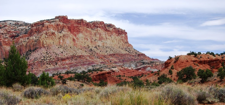
"The Big Rock Candy Mountain," (not the real one for it doesn't exist,
but this is located along US 89, just north of Marysville, Utah)