 |
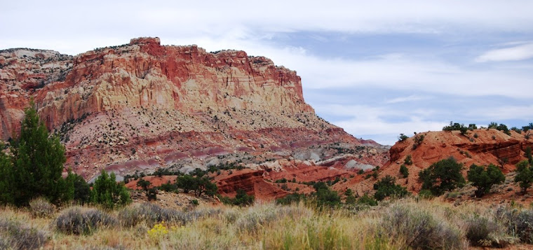
| Looking at the Sierras |
On Friday morning, July 19, I had a decision to make. Not being expected in Virginia City until
late in the day, I had time to explore.
I could backtrack a little on US 6 and then take Nevada 360 back through
US 95 (following the old railroad bed of the Carson and Colorado), or I could
continue on California 120 to Mono Lake.
Although I had never driven the 23 miles of Nevada 360, I’d driven 95 up
through Mina, Hawthorne and Yerington many times. I’d also been by Mono Lake many
times, but only once had I spent time walking along its shore and that was back
in 1988. I decided to head to the lake.
 |
| The roller coaster road bed on CA 120 |
Although I had also driven California 120 many times, heading from
Utah to Yosemite, I had forgotten how much part of the highway is like a
roller coaster. From Benton Hot Springs,
the road climbs the sage covered hills and once on top, it seems as if they
forgot to grade the road and just laid asphalt on the rolling hills, with short
pitches of roadbed followed by quick short drops that leave your gut hanging a
100 feet overhead. You also worry about
what’s on the other side of the pitch because you can’t see down into the
trough until you're headed down. Although
there is little traffic on this road, this is open range and it’s always
possible to find a cow loitering around at the bottom, something that wouldn’t
do either of us any good. However, I
enjoy the drive and after about 30 miles, the Sierras began to loom in the
distance and Jeffrey Pines begin to replace sagebrush and the occasional pinion
pine.
 |
| Young Jeffrey Pines at site of old mill |
I stop at a new interpretative site for Mono Mills, a
sawmill that stripped the largest forest of Jeffrey Pines in the world. I have always liked this variety of pine and
think of them as kin as we share the same name.
Today, the Jeffreys growing here, whose bark has the distinct smell of
vanilla, are all second growth. During
the heyday in Bodie (a mining town north of Mono Lake), there was a short-line
railroad that ran to this mill, but the train (which never connected to another
railroad) was abandoned in 1917, as the mines died out and the forests were
depleted. You can still see a few
railroad ties at the site of the mill.
According to the interpretative signs, when the railroad was abandoned,
it was sold for scrap and brought in more money than the investors had
originally paid to build the line. I
expect World War 1 and the high price of scrap metal had something to do with
the bonus its investors received.
 |
| Looking toward Yosemite from Mono Lake |
A little further down 120, I take a right on a gravel road
that leads out to the shores of Mono Lake.
It still feels as if I’m far from
civilization, but as I am walking up to the ranger station to pay my three
bucks for a day-use permit, I’m shocked with the ringing of my cell phone. I didn’t even realize I was again connected
to the larger world as I’d pretty much been disconnected since leaving Tonopah
yesterday (yes, there are still places beyond the reach of a cell phone). I take the call, but then
turn the ringer off.
 |
| Brine flies that line the lakeshore |
Mono Lake is a unique place.
Nestled in a basin, the water runs off the backside of the Sierras and
down from the Bodie Hills and from the volcanic craters to the south and ends
up in an evaporating in the lake where the water leaves behind its mineral
content. As a result, the lake is
extremely salty, as are similar bodies of water: The Great Salt Lake in Utah,
Pyramid Lake in Northwestern Nevada and the Dead Sea in the Middle East. Although there are no fish in these waters,
the waters are full of brine shrimp and flies, the later which do not bite but cover the shoreline and at times look like moving carpet as they make a way for
you to walk through them. The flies and
shrimp attract birds and the lake is home for many species of birds as well as
a stop-over point for many others during migration. Also unique about the lake are tufas that
line the shoreline, limestone statues created over the centuries as spring
water laden with calcium percolate into the waters of Mono Lake. The calcium in the spring water bonds with
the carbon in the lake water to create calcium carbonate. As the lake level falls (it has a history of
rising and falling), it exposes these unique statues, giving the shoreline of
Mono Lake an appearance that seems as if should be from another planet.
 |
| Tufas |
For much of the past century, the lake has been falling
rapidly as tributaries that bring water from the surrounding mountains have
been diverted to Southern California to wet the thirst of those in the Los
Angeles basin. However, in the mid-90s,
a lawsuit was settled that forced the water authorities to allow more water to
drain into the lake, allowing the lake to rise to its 1963 level. This level is still way below the 1930s
level, but is significantly above the level it was in the early 1990s. The ranger informed me that the lake has
risen at least 10 feet since I’d walked along it’s shoreline in 1988. When the lake reaches the 1963 level, the
water authorities can again tap into the streams coming into Mono Lake, but
must allow enough water to flow into the lake to keep it at a constant level.
 |
| Birds feasting on shrimp and flies |
In the early afternoon, I leave the lake. I wished I had more time to explore but I was
getting hungry. I continued on west on
California 120, toward the Sierras that were now looming over me. Reaching US 395, I turned north and drove to
the small community of Lee Vining. I have
to resist the temptation to take a left and head up Tioga Pass and into
Yosemite. Not seeing anyplace that I
want to eat in the overly touristy town of Lee Vining, I continue on to
Bridgeport (again, resisting the temptation to turn, this time to the right and climb up into
the heights and visit, once more, the town of Bodie—a ghost town turned state
park).
In Bridgeport, which I’d always considered a cow town, I
stop at the Burger Barn, where I enjoy an Elk Burger. While there, I talked with a northbound
thru-hiker along the Pacific Crest Trail.
She gives me her trail name, but for some reason I don’t record it in my
journal so I won’t be able to look and see if she makes it by the end of the
hiking season. She’s waiting at the
Burger Barn for a promised ride back up to Sonora Pass (this is quite a drive and she's lucky to have someone going that direction). Leaving Bridgeport, which I found to be
busier than it was the last time I’d been through here in the late 1980s, I drive
on up 395, through the Walker River Valley, amazed at the number of new
businesses that have popped up since my last time in this part of the
country. Also amazing is the growth
south of Carson City. The towns of
Gardnerville and Minden no longer seem separate from the state capital. In Carson City, I take a right on US 50. One last surprise was at Mound House, just
east of Carson City and my turn on Nevada 341 for the drive up the mountain to
Virginia City. Above the highway was a
trestle for the Virginia and Truckee Railroad which now extends all the way
from Virginia City to the Carson River.
 |
| Kayakers on the lake |
You have the best adventures!! Looking forward to the next one.
ReplyDeletewow...some pretty cool structures left in the draining down of the lake...i am glad they allowed it back up a bit and did not just kill off this whole ecosystem...brine flies...sounds a bit nasty...ha...i like the shot of yosemite....
ReplyDeleteWater may well be the cause of the next civil war. My guess is the development of Nevada is directly related to the majority population county of Las Vegas long barren stretches and now almost everywhere that has people sounds like a tourist spot for souvenirs.
ReplyDeleteI think a fellow could travel around all his natural life and still not see all there is to see here in the continental U.S. Makes me realize that I need to do the best I can with the time I have left.
ReplyDeleteWhat a great travel log! I've never been to Mono Lake but have put it on my "Go There" list.
ReplyDeleteI do wonder about the expansion of we humans and the demand it puts on water resources. The desert can be a dangerous environment and the high desert perhaps even more so because everything dehydrates so rapidly. Perhaps the desert rats who persist will develop a tough hide like the snakes, lizards and plants that inhabit this area.
Look forward to your next installment. You certainly know your Rail lines!
Beautiful. So many wonderful geographical features in our world.
ReplyDeleteThere is a serious difference between the two States. Space age-Stone age sort of contrast. Even the village of Mono looks healthy and there isn't 40 houses in the place. Does Vegas and Reno/Carson metro area suck the life from Nevada.
ReplyDeleteThat area is truly lovely.
That lake has another 36ft X 16 sq miles to go before it get to a level to hide the beach lines. :-)
Interesting adventure.
ReplyDeleteLooks like a great drive, lovely photos and Mono Lake sounds fascinating.
ReplyDeleteI began to read your post and the first sentence of your second paragraph has stayed with me somewhat. I also love your country! :-) If there's a dream I have is to travel the entire US, from east to west and south to north. I know it would take me a couple of years at least to accomplish this feat. Mainly because, knowing myself, I wouldn't just stop in a place for the night and drive off the next day without finding out as much information about is history and culture first. I loved your post and your photos. Many thanks.
ReplyDeleteGreetings from London.
PS: By the way, one of the ads that came up at the end of your post was for Chelsea Football Club, the team I follow in the English Premier League. Thanks for the "blue" welcome! :-)
Lovely scenery! It sounds like a great drive!
ReplyDeleteSo pretty!
ReplyDeleteI have a friend that says Mono Lake is like her favorite place on earth. I can kinda see why in that big picture :)
I love a meandering drive like that.
ReplyDeleteYou should seriously write some traveling memoirs :)
ReplyDeleteFANTASTIC post! Your photos and narrative are riveting. I remember the first time I saw Mono Lake as a kid. I was amazed and have been felt that way every time I've been there. I'm happy to see that it is still amazing.
ReplyDelete