This is another installment of recount of my 1987 hike on the Appalachian Trail. I’m getting close to the end, with probably two more post, one telling about my time in Monson, Maine and the second post on the last 116 miles of the trail, from Monson to the top of Katadhin. Somehow, I’ll have to then link all the post together (including posts about the southern 800 miles of the trail, some of which isn’t yet written). When that’s done, you’ll be able to follow me along the entire 2000 mile journey. The photo below is of Paul, one of the "Brits."

 That night I had two weird dreams. In the first, I was with a bunch of people in a secure bomb shelter, waiting for the beginning of a nuclear war. There was, in the shelter, a small blonde woman whose attention I kept trying to get, but to no avail. I was more concerned about meeting her than with the pending war, but soon the radio announced that the war had been averted and it was safe to leave the shelters. We all stepped out into the streets of a deserted town. In the second dream, a war had occurred, but only a few bombs had been dropped. I was with the woman in the first dream, in a fallout shelter. It was just the two of us and we were preparing to wait till the worst of the radiation was over. Although I had not gotten high, I wondered if the smoke had affected my dreams.
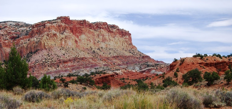
August 15 was long and hard. We climbed the rest of the way over Sugarloaf, then Spaulding, the two Crocker Mountains. I took a late break in the afternoon, noting that Bigelow Mountain was about to kill me. It was the last 4,000 foot peak before Katadhin, 180 miles to the north. The day had been was hazy and muggy with light rain. I finally found the strength to push on and after 18 miles, arrived in the rain at the Horn Pond Lean-tos at 6 PM.
The next morning, August 16, was Sunday, the Lord’s Day. I felt like crap. In the morning, my whole body ached and after a two hour lunch break, only my stomach hurt. Something wasn’t ticking right inside. I tried to distract myself, listening to the radio and learned that in Lewiston, Maine the temperature was 97 degrees. It was a heat wave in Maine. I turned the station and picked up some radio Bible Study and listen, thinking it would be like attending church. After a few minutes of listening to a teacher, I decided he was full of crap. It has always amazed me how those who claim to approach scripture so literally can have such vivid imaginations for interpreting text as to how the world was going to end) literal imagination for a few minutes before deciding the teacher was so full of it that I could do without listening to him… We only hiked about ten miles, which was good for me as I was fighting off some bug (or bad water).


“I don’t know how anyone can live in a country,” Dave said as he swatted another mosquito, “where something is always biting you.”
Hiking with the Brits have been enjoyable. On August 14th, we’d camped on Spaulding Mountain, after having hike over Saddleback, the Horn and Lone Mountain, a three and a half mile stretch above tree line. Having been on the trail all summer, we were not in tune to what was happening in the world and unaware that less than a mile north, on the summit of Spaulding Mountain, there had been a celebration this afternoon for the 50th anniversary of the completion of the Appalachian Trail. This section of the trail, over Spaulding Mountain, was the last part of the trail finished by the Civilian Conservation Corps in 1937.
Sitting around a fire that evening is Slim Jim and me, along with the Brits and two French Canadians. The Canadians asked us about our travels and we shared our tales. Dave and Paul tell about their two encounters with skunks on the trail. Coming from Great Britain and not being familiar with American wildlife, they were sleeping in the north Georgia Mountains, just after starting the trail. It was cold and they had set up the tent and placed their packs right outside the door. The two shared a lot of equipment, including a single flashlight which they called a torch. Unlike the mini-lights most of us carried, they had a five cell mag-light, one like the police used. That night in north Georgia, Dave heard something gnawing on their packs and woke Paul up, asking for the Torch. Taking the light, Dave unzipped the tent and reached out and pounded the critter. The skunk wasn’t amused and sprayed into their tent.
Over the past few days, I’ve witnessed several mini dramas along the trail. Today’s by a ruffled grouse, was really impressive. The bird stepped out into the trail, right in front of me and ran in front of me, leaning to her side and acting as if her wing was broken. After a good 25 yards or so, she took off and flew perfectly, having led me away from her nest. Along the trail, I’ve seen spruce grouse and pheasants also act out being injured in order to draw us away from their nest. As we keep walking, they must assume their little dance is working and that they are the master of their fate (or at least the protector of their brood).

With the exception of the miles above tree-line, the day had been long and I had a hard time getting into the flow. I took a long nap at lunch. I wasn’t feeling the best. Then, as I began the climb up Spaulding, a strap on my waist belt broke, causing the pack to list to one side. I sewed the strap back on with dental floss and one of the large leather needles that I carried in the small New Testament and Psalms Gideon Bible that my dad had given me when I set out to do the trail. I did a quick job, sewing it enough to hold it together till evening. I then took another nap, sleeping on my back on a rock. I then pulled out my little radio and finished the day’s hike listening to a classic rock station that played a lot of Motown along with the Doors. Jim Morrison belting out, “Don’t You Love Here Madly,” helped me get into the grove. As we sat around that evening, Paul fixed a joint from some pot we’d found the day before hidden in the rafters of a shelter. Some hiker must have forgotten his stash. As we talked, I put in a bunch more dental floss stitches in my pack’s waistband, hoping I could keep it together till I reached Katadhin. I also wrote in my journal, crediting the station with getting me through the day, only to come back early in the morning and write that I’d prayed for strength and the credit I’d given to rock stars really belonged to God.
 That night I had two weird dreams. In the first, I was with a bunch of people in a secure bomb shelter, waiting for the beginning of a nuclear war. There was, in the shelter, a small blonde woman whose attention I kept trying to get, but to no avail. I was more concerned about meeting her than with the pending war, but soon the radio announced that the war had been averted and it was safe to leave the shelters. We all stepped out into the streets of a deserted town. In the second dream, a war had occurred, but only a few bombs had been dropped. I was with the woman in the first dream, in a fallout shelter. It was just the two of us and we were preparing to wait till the worst of the radiation was over. Although I had not gotten high, I wondered if the smoke had affected my dreams.
August 15 was long and hard. We climbed the rest of the way over Sugarloaf, then Spaulding, the two Crocker Mountains. I took a late break in the afternoon, noting that Bigelow Mountain was about to kill me. It was the last 4,000 foot peak before Katadhin, 180 miles to the north. The day had been was hazy and muggy with light rain. I finally found the strength to push on and after 18 miles, arrived in the rain at the Horn Pond Lean-tos at 6 PM.
The next morning, August 16, was Sunday, the Lord’s Day. I felt like crap. In the morning, my whole body ached and after a two hour lunch break, only my stomach hurt. Something wasn’t ticking right inside. I tried to distract myself, listening to the radio and learned that in Lewiston, Maine the temperature was 97 degrees. It was a heat wave in Maine. I turned the station and picked up some radio Bible Study and listen, thinking it would be like attending church. After a few minutes of listening to a teacher, I decided he was full of crap. It has always amazed me how those who claim to approach scripture so literally can have such vivid imaginations for interpreting text as to how the world was going to end) literal imagination for a few minutes before deciding the teacher was so full of it that I could do without listening to him… We only hiked about ten miles, which was good for me as I was fighting off some bug (or bad water).

I’ve lost my flashlight. We bivouac on the ground, under the stars. I dream of my ex-wife. She calls me and asks me to come over (she’s at her parent’s home). As I’m driving over, I debating if this is the right thing to do, but when I get there, she runs from her father’s ham shack out back and grabs a hold of my neck and kisses me with tears in her eyes. I wake up and have a bad case of the runs. I pull on my boots, grab my toilet paper and head off into the woods a ways and kick a hole just in time. The stars are out but there is no moon. After I finally finish and my butt is sore and on fire, I kick dirt over my load, hoping I got it covered, and then head back toward where I thought I was sleeping but get turned around. I try to look for large trees where we were camping, but the ones that I pick out are not the right ones. I stop and debate on what to do. I could yell and wake up Jim and the Brits and Dharma Bum (a hiker from Vermont who’s taken his name from one of Jack Kerouac’s novels), or I could just sit and make the best of it and wait till dawn. I’m just about ready to wait for the sun when I stumble over Paul and am then able to reorient myself and find my sleeping bag.
The Brits take off early the next morning, hoping to catch the Kennebec River hiker ferry today (it runs only between noon and 2 PM). They are planning on climbing Katahdin on the 27th and then head to Portland Maine and stay with Larry and Mo and work to earn enough to get back to Britain in time for Paul’s sister’s wedding in late September. I’m sad to see them go as we’ve been together, off and on, since central Pennsylvania.
The heat wave continues and my stomach remains unsettled, but I am able to make 10 miles before lunch. At least my whole body isn’t aching like yesterday morning. I stop for lunch at East Carry Pond, spending time afterwards lying on grass. A brown garter snake comes up to me and gives me a “one-over” before heading back into the brush. I’m reading Fredrick Buechner’s novel, Treasure Hunt, and am amused at the Evangelist Leo Bebb, the protagonist, desire to “do something big for Christ and how he’s realized the only really big thing he’s done is to sell Bibles door-to-door. Much of the trail today follows the Arnold Trail, used by Benedict Arnold on his attempt to attack Quebec during the Revolutionary War. I reach Pierce Pond Shelter at 4:15 PM. The lake is beautiful and I take a nice swim. I’m feeling better. During the evening, Jim and I are joined by a group of four adults with a four year-old boy, all from Rhode Island. The boy’s name is Josiah has a small day pack with Ernie of Sesame Street sticking out of it. They also have a black lab in tow, named Thunder. As we sit around watching the sunset from the falls at the mouth of the lake, one of the men tells about Kenneth Robert’s novel, Arundel, which is about Arnold’s invasion of Quebec. He also recommends Alfred Lansings book, Endurance: Shackleford’s Incredible Voyage. Slim Jim tells about a book he read earlier in the hike, Henry Kid Doylan’s I Rode with Stonewall.
We make a slow start of it on August 18, knowing that we don’t have far to go till we’ll have to wait for the ferry. The nearby lodge at the mouth of the lake (near the falls) serves pancakes. We head over to the place, “Harrisons” and eat some of the best pancakes I’ve had in my life before completing the 3 ½ mile hike to the river. We get to the river well before noon and take a swim. The only safe time to wade across the river is early morning, before the dam upstream starts releasing water. Jim and I swim in the river. It’s deep. The ferry, which is just a canoe, is operated by volunteers. The guy is early today and we place our gear and boots in the boat and swim across the river as the volunteer paddles our gear. It’s only a mile to the town of Caratunk and we’re there a little after noon. Jim has a mail drop here, but the post office is closed till three. There’s not much to the town, not even a store, just a two room school, a one truck fire department and the part-time post office. We fix lunch and then nap behind the school waiting for the post office to open. A guy staying in a nearby cabin comes in for his mail and greets us. He’s got a jug of lemonade, knowing he’s liable to run into hikers. Although it’s not as hot as it has been, the lemonade taste wonderful. After Jim gets his mail, we hike on a few miles to Pleasant Pond Lean-to. I’m surprised to find that I didn’t lose my flashlight. I was thinking I’d have to find a new one in Monson, but I find it at the bottom of my food bag.

Slim Jim looking north
On August 19, Jim and I continue at a slow pace. We stop for lunch at Joe’s Hole, cross a two-wire cable bridge over Baker Creek (an experience in a full pack), enjoy great afternoon views from Moxie Bald fire tower. From the peak, we watch thunder clouds build and hike on north. At 4:30 PM, we reach Moxie Bald Lean-to, where we stop for the day. The lake is beautiful and we watch loons fish for dinner, seemingly unfazed by the threatening storm clouds building overhead. A little later, we’re treated to an incredible lightning show, but receive only a little rain.
The loons wake me the next morning at 5:15 AM. I walk down to the water and in the predawn light can make out a cow moose and calf feeding out in the water. By the time the sun is rising, I’m eating oatmeal and drinking tea on a rock overlooking the pond. Today’s hiking is easy and Jim and I quickly make the 17 miles to Monson, arriving a little after 2 PM. We get bunks at Shaw’s Boarding House and set out to see the town. This is the last town on the trail and the last public road we’ll cross before we reach Baxter State Park and Mt. Katadhin, 116 miles to the north.
The loons wake me the next morning at 5:15 AM. I walk down to the water and in the predawn light can make out a cow moose and calf feeding out in the water. By the time the sun is rising, I’m eating oatmeal and drinking tea on a rock overlooking the pond. Today’s hiking is easy and Jim and I quickly make the 17 miles to Monson, arriving a little after 2 PM. We get bunks at Shaw’s Boarding House and set out to see the town. This is the last town on the trail and the last public road we’ll cross before we reach Baxter State Park and Mt. Katadhin, 116 miles to the north.


 Next, I decided to test my stove using both denatured alcohol (which you can find in the paint section of any hardware store) and regular rubbing alcohol (which is only 70% pure, so doesn't put out as much heat). The alcohol gets poured into the middle of the top (larger holes, the flames come out the side holes). I put a pot of similar size with 24 ounces of water in each. The rubbing alcohol stove had a harder time staying lighted, so I ended up lifting the pot up over the stove with a few rocks I garnered from the flower bed...
 I now feel I can make such a stove from easily obtained products, but when possible I think I'll stick to my MSR multi-fuel stove. This is the second of these I had (the first was the original and sounded like a jet taking off and still works, 20 some years later. This whisper-lite is really nice, as it is quiet and doesn't use as much fuel.) I would recommend paying the extra ten bucks for the multi-fuel variety as it allows you to buy fuel from a gas station and not having to pay the expensive (and deal with having the extra fuel you don't need) Coleman fuel.

